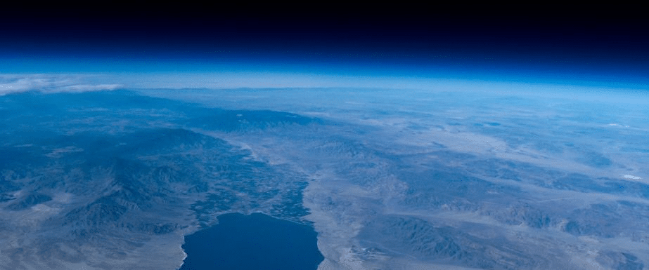
The weather balloon might be seen as an old-school technology, but with today’s modern electronics, rocket scientists only dream of the low-cost capabilities that these balloons have that can provide images of the world from above. I have launched over 100 of these weather balloons, and I’ve trained hundreds of educators across the country to help them implement balloon programs within their core curriculum. You can download my guide to learn more about how to start a weather balloon program at your school or district.
Flight & Atmosphere
Meteorologists use weather balloons to study the atmosphere and you might say, “Hey, we have satellites that give us all this information,” but the meteorologists will send these balloons up to gather more than just images of the earth. Typically, they will incorporate technology that can record temperature, pressure, and humidity, and they can actually sample the atmosphere directly. They use that sample to take a look at satellite data to confirm that it’s correct or instead, change the models. They also include some kind of GPS for telling us where the balloon is at any given time.
What’s interesting is that this is a great example of global cooperation. There are over 900 sites around the world that send up meteorological balloons or weather balloons every day, and they are coordinated so that they all launch around the world at exactly the same time – noon and midnight London time. All that data is fed into computers along with the satellite information to give us the forecasts we have each day within our apps and on TV.
In the early 2000s, hobbyists and educators started using weather balloons to send up student projects that also had tiny cameras on board. When I started, we were still launching film cameras. You would go to Walgreens and get it developed so you could see what was happening!
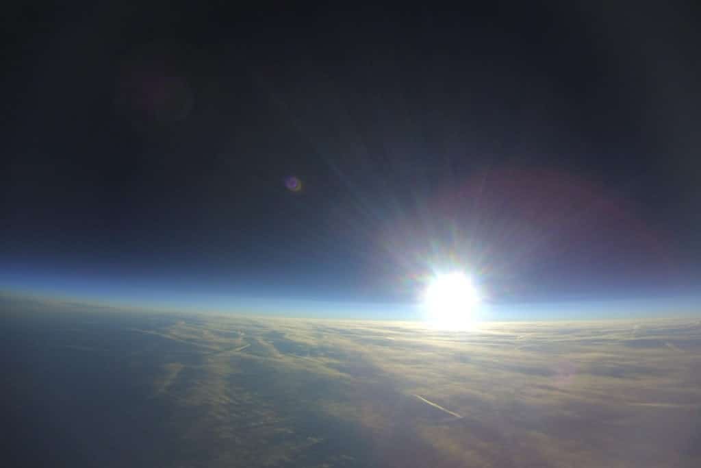
Nowadays we have these small GoPro cameras – this is how these images and videos that you’ve seen on YouTube are taken. It looks like the balloon went into space. These balloons will reach over 100,000 feet in altitude or 30 kilometers, which is above 99% of the atmosphere by volume. But is this really space? I’ll cover that topic in another post soon.
Balloon & Lift Gas
The best part about this is that you don’t need to be a rocket scientist in order to launch these balloons. Most organizations use a latex balloon. This is typically like a very large party balloon. It is a thicker rubber and when filled, it can reach a size of about six feet across while on the ground. After the balloon is filled, it will be released and will rise about 1100 feet per minute or 5 meters per second traveling through the troposphere to the tropopause , which has an average temperature of about -40 degrees Fahrenheit, but it can get colder depending upon he time of the year. The weather balloon will carry a parachute as well as a payload or a box with the sensors to detect items such as temperature, pressure, humidity and GPS. It will rise through the atmosphere, and after leaving the tropopause it will enter the stratosphere.
We can recognize when this is happening because there is a change in the temperature. It actually starts warming up because the UV radiation is absorbed by the ozone layer at this level. When we see that temperature change, we know we’ve entered the stratosphere. The stratosphere typically is about 50,000 feet above the earth. As the payloads and balloons ascend through the atmosphere, the balloon will grow in size. This is due to the helium or the hydrogen matching the pressure outside the balloon, and the air pressure as you go up in altitude decreases.
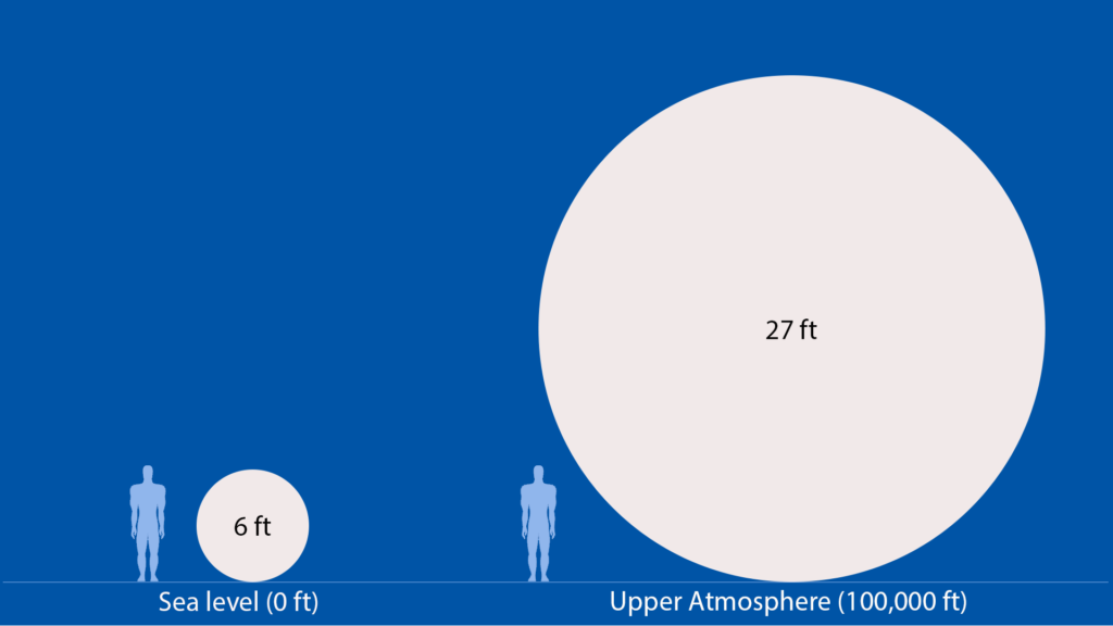
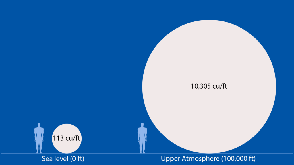
As I mentioned before, when we first launch a balloon, it is about six feet across, but right before burst, it will grow all the way to approximately 27 feet across. This is about 4.5 times its original diameter, but if we use those same numbers and plug it into the formula for the volume of a sphere, we see that on the ground, we have approximately 100-200 cubic feet of helium, but at its highest altitude, when it’s 27 feet in diameter and 100,000 feet above the earth, you may have a volume that’s 10,000 cubic feet. When the balloon reaches its maximum size, it will burst and start falling back to earth.
The parachute kicks in immediately as it is hanging right underneath the balloon, so there’s no need to deploy it like a skydiver would. But the unique thing is that it starts falling at about 120 miles an hour. There’s nothing catching in the parachute. The molecules that high up in the atmosphere are super far apart and the air density is very low , so the payloads are falling toward the earth very quickly. There’s even a small time frame of zero Gs experienced by the payload and the rest of the balloon as it starts falling. As the atmosphere increases, the balloon slows down and it will land at around 10 miles an hour.
Tracking & Sensors
Weather tracking can be quite complicated. Meteorologists will use a pretty fancy system that uses line-of-sight technology like a walkie-talkie and giant antenna on the ground to get the data back into their computer systems.
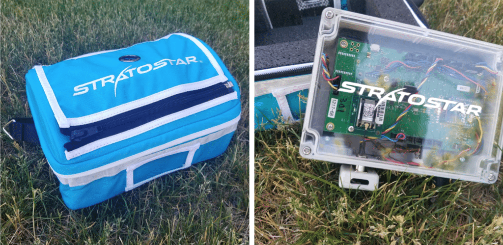
Hobbyists and educators can use ham radios and hiking GPSs, but at my company, StratoStar, we developed a satellite-based tracking system, so the sensor and the tracking data sent to satellites is then sent to the Internet and allows anybody with access to a web browser (tablet, computer, phone) to track along on the map. Students can see in real time where the balloon is as well as all the data via graphs within the tracking system. We also incorporated social media feeds so you can see what’s happening at the launch site or in the tracking vehicles even though you can’t be there. We just wanted to make things really simple so that you can implement this within your school or district.
Recovery
Meteorologists track the data up until burst, but they do not recover the payloads. No one goes out to find these balloons. They just land where they land. There’s an address on board and it says that if you send it in, there might be a small reward, but as far as I can see on the Internet, only about 10 to 20% of these are returned.
But for hobbyists and educators, the whole purpose of this activity is that you can track and recover your payloads so that you can fly again and you can get that footage off your action cam. There are some very specific tips and tricks and equipment that will increase your odds of recovery as well as some things that you should never do, and I go over all this in my free weather balloon program guide .
If you’re looking to start a weather balloon program for your school or district, please grab my free guide on how to start building your team and generating ideas of where you can implement these weather balloon launches within your science or STEM curriculum. If you would like some tips and tricks on how to fly weather balloons with a camera, I have a YouTube channel you can check out. If you have any questions, please leave a comment or you can contact me directly .
I look forward to sharing all my knowledge about weather balloons so that you can fly and implement this within your classroom to make learning real!

